Concerning number of pedestrian fatalities identified by RSA
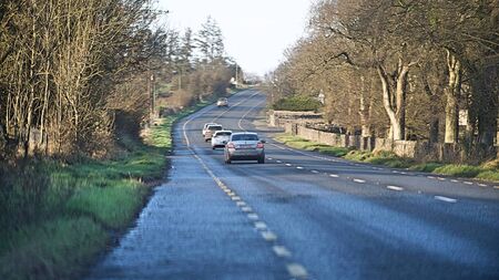
The volume and speed of traffic travelling on the N61 remains a source of concern. Pic: Gerard O'Loughlin
There were 36 fatal road traffic collisions recorded on the county’s roads between 2016 and 2024, resulting in 37 fatalities, with a concerning number of them pedestrians.
Ten of these fatal collisions took place on the old N5, with a number of them happening in the Strokestown area, new data from the RSA has shown. There were also a further five fatalities on the N61. Two deaths were recorded on the old Ballinasloe Road in South Roscommon and a further two on the R357 to Shannonbridge.
There were 139 collisions where serious injuries occurred, with a cluster of them occurring in the Fourmilehouse area on the N61, while the N60/N63 saw 11 serious injury collisions. During the nine year inclusive period, there were 510 non-serious injury road traffic collisions throughout the county recorded.
In terms of the county’s towns, Castlerea saw four collisions with serious injuries, with seven in Roscommon Town. Boyle saw one fatality and four serious injury collisions. In Ballaghaderreen, there were three serious injury collisions and one fatal collision.
Of the deaths on the road, 22 were drivers, three were passengers, three were motorcyclists, eight were pedestrians, and one was a cyclist. There were 157 serious injuries, with 87 drivers and 30 passengers being seriously injured. Thirteen cyclists and 15 pedestrians were also seriously injured.
Last week, a new online interactive map of injuries and fatalities was released by the RSA, identifying the location of road traffic injury collisions across Ireland. It contains data on fatal, serious and minor injury collisions that occurred on public roads between 2016 and 2024.
The map is an important tool for members of the public, researchers, local authorities and other stakeholders with an interest in road safety and collision data, the Road Safety Authority said.
The data displayed on the map is based on injury collision information collected by An Garda Síochána. The RSA will update the map annually as new data becomes available.
“The publication of the map comes against the backdrop of continuing concern over road fatalities,” the RSA added.
Local TD Dr Martin Daly welcomed the publication of the map, calling it “an important tool in identifying accident blackspots and understanding where targeted investment and road safety measures are urgently required”.
“The data clearly illustrates the significant number of serious and fatal collisions that have occurred on roads throughout County Roscommon, particularly along the N5 and N61 routes,” he said. “My thoughts are with every individual, family and community affected by these tragic incidents. Behind every statistic is a person, a family and lives changed forever.”
While he welcomed the ongoing progress on the N5 upgrade and bypass works, “which will undoubtedly improve safety for motorists and surrounding communities”, he said he remained deeply concerned about the volume and speed of traffic travelling on the N61.
“Despite being designated a national secondary route, the level of traffic using the road is substantial, particularly between Athlone and Roscommon Town,” the Fianna Fáil TD said.
“During recent visits and engagements with residents, schools and community groups along the N61 corridor, serious concerns were repeatedly raised regarding pedestrian safety and the difficulty motorists experience when entering and exiting onto the roadway.” The situation at Ballybay National School, Kiltoom, was of particular concern and described as an accident waiting to happen, he said.
“The RSA collision map provides clear evidence that further investment and safety improvements are needed. I will continue engaging with the local authority, the RSA and the Department of Transport to advocate for additional road safety and traffic calming measures throughout County Roscommon,” said Deputy Daly.