Satellite imagery reveals exact amount of flooded land around Lough Funshinagh
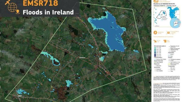
A satellite image of the flooding around Lough Funshinagh. Pic: Copernicus EMS
Satellite imagery conducted by a specialist company has revealed the exact amount of flooded land around Lough Funshinagh.
Copernicus Emergency Management Service, which provides mapping products based on satellite imagery, detected a total flooded area of 84 acres around the turlough.
The severe flooding caused by Lough Funshinagh in South Roscommon has devastated lives and livelihoods.


